TRAIL INFORMATION
ACTIVITIES
BIKING
The Armstrong Trail currently has 30 miles of trail, including some share-the-road sections, available for cyclists to enjoy. Trail heads at Rosston, Ford City, Kittanning, Cowanshannock Creek,Templeton, Rimer, Redbank, Phillipston, and East Brady give easy access to hours of cycling enjoyment. CLICK HERE for listing of designated parking areas.
HIKING
Whether you hike a mile or 30 miles along the Armstrong Trail there are plenty of opportunities to explore our beautiful countryside. Signs of days gone by – river travel (Grays Eddy), iron ore production (Monticello Furnace, Redbank), railroad travel (Coaling Tower at Redbank, Brady Tunnel (closed), Phillipston rail yard & turntable) can be found. The sides of the trail are alive with beautiful wildflowers. Especially worth the trip are the spring wildflowers in the area around milepost 52.5. Please send updates about locations of other wildflowers to the Armstrong Rails to Trails Facebook page. Pets are welcome, but remember all pets must be on a leash at all times.
BIRD WATCHING
From turkeys to turkey vultures, from tiny finches to majestic bald eagles, the Armstrong Trail provides the opportunity to see and study dozens of native bird species. As of the Summer of 2013 there are 3 bald eagles nesting across the river from the trail below Lock & Dam #9. Please send updates of interesting bird sightings to the Armstrong Rails to Trails Facebook page.
GEOCACHING
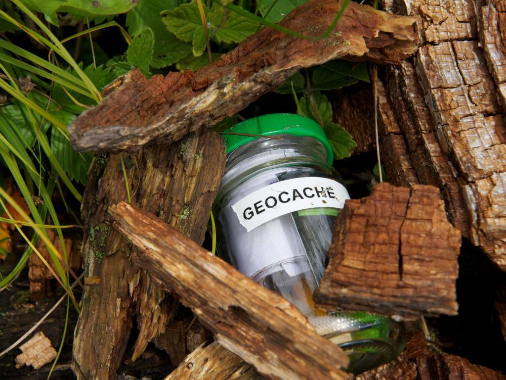
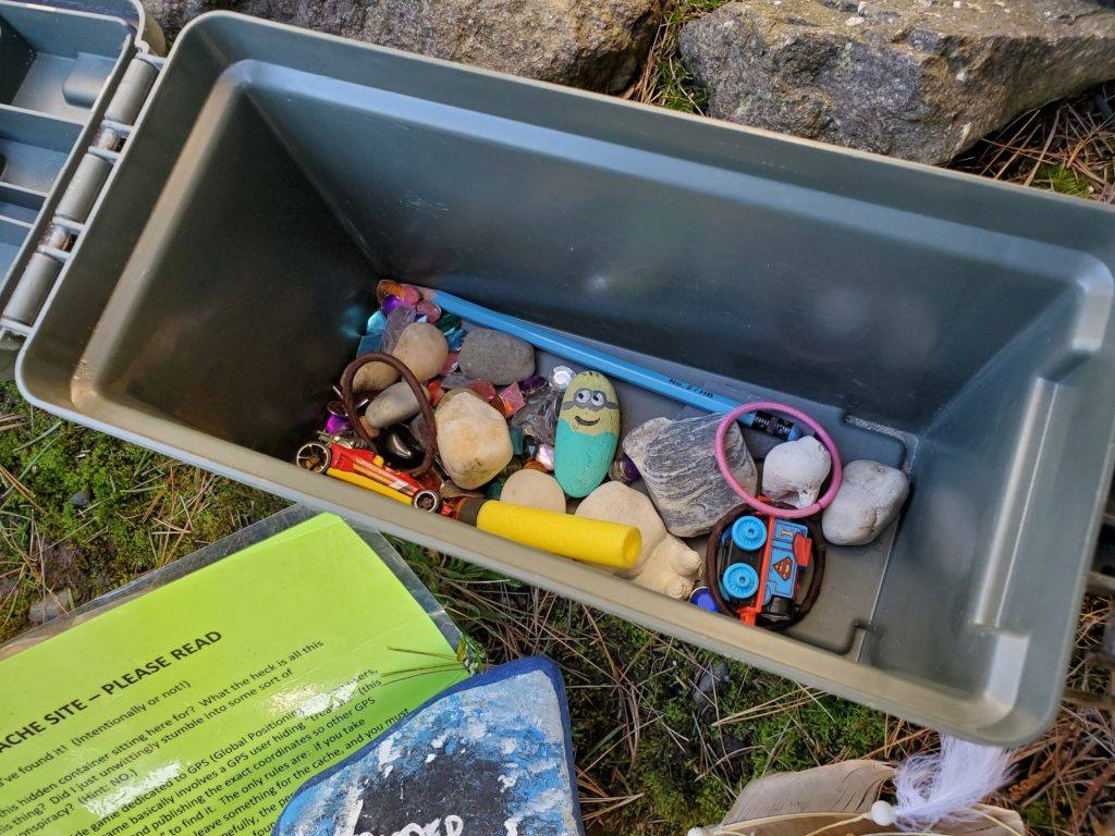
Geocaching is the world’s largest treasure hunting game. Founded in 2000, Geocaching is dedicated to inspiring and enabling discovery, exploration, and adventure though a unique combination of outdoor recreation and location-based technology. The game’s passionate community of millions of players use the Geocaching app and GPS-enabled devices to find cleverly hidden containers called geocaches. Today, there are more than 3 million geocaches in over 190 countries including many along the Armstrong Trail. For more information go to geocaching.com.
FISHING
Trail users may fish from the Rosston parking area (mile 39), the Pennsylvania Fish & Boat Commission parking area in Templeton (mile 53.7) and across from the Cowanshannock Trail/Bernie Snyder Picnic Area (mile 47.5). A valid Pennsylvania fishing license is required and must be displayed at all times by those who are fishing. CAUTION: Most of the Armstrong Trail runs through private property and trespassers may be prosecuted by these landowners.
BOAT LAUNCHES
The Allegheny River can be accessed by boats, canoes, kayaks, and other watercraft from designated locations along the Armstrong Trail. Boat launch areas can be found at Rosston, mile 39, Kittanning Riverfront Park (1/2 mile from trail) near mile 44, the Pennsylvania Fish & Boat Commission parking lot in Templeton, mile 53.7, and along Cowanshannock Creek near the Bernie Snyder Picnic Area, mile 47.5.
CAMPING
To camp along the trail, permission must be received from the ALLEGHENY VALLEY LAND TRUST (724 543-4478). Camping is only permitted in designated areas. Private campgrounds in the area can be found in AMENITIES NEAR THE TRAIL. CAUTION: Most of the Armstrong Trail runs through private property & trespassing may be prosecuted by these landowners.
CROSS COUNTRY SKIING
When the weather outside is frightful, cross country skiing along the trail can be delightful! The trail has very little slope and is easy to navigate. Ski at your own risk.
HORSEBACK RIDING
Due to the narrowness of the trail right of way in many areas of the trail and out of respect for adjacent land owners and other trail users there are currently no designated areas for horseback riding along the Armstrong Trail. Horseback riding on the regular trail surface is prohibited due to the potential damage to the trail.
POINTS OF INTEREST
PHILLIPSTON TURNTABLE & TRAIN YARD – The rail yard at Phillipston was built in 1867 to be the main service station for locomotives along the Allegheny Valley Railroad. Originally the Phillipston yard contained 1.7 miles of track, a wooden 2 stall engine house and a 75 foot wide turntable. Along with servicing locomotives, the 13 tracks in the yard were used as a classification area to assemble trains for various destinations. Construction of the turntable was completed in 1877 & was used to turn loco-motives around for return trips. A locomotive was driven onto the turntable, then spun 180 degrees, so it would be ready to pull a train in the opposite direction. In 1886, the Phillipston service station & other buildings burned down but were quickly rebuilt due to their importance in maintaining railroad transportation in the area.
BRADY TUNNEL – The railroad was built in this area between 1855 and 1870, using the relatively flat Allegheny River corridor as a cost efficient location for the tracks. In the early 1900’s, train traffic was heavy: up to 5 passenger trains and 25 freight trains in each direction daily, which justified installing double tracks. This also led to the building of the 2,468 foot Brady Tunnel. Using the tunnel to bypass Brady’s Bend shortened the train trip by 5.36 miles and avoided the high degree bends of the track along the rail line. Construction of the tunnel began in February 1913. Dynamite was used to blast through layers of rock, shale, and coal, then steam shovels cleared the tunnel. Large wooden beams were fitted against the walls and a 2 foot concrete liner was installed. Bricks providing additional support in areas where the tunnel height exceeded 14 feet. During construction many delays occurred due to falling rock. Construction was completed and the tunnel opened for use on May 28, 1916.
xx

REDBANK – This area became known as Red Bank Landing in the 1800’s because of the frequent raft and boat traffic on the river. Red Bank Landing was the northernmost depot for goods being shipped up and down the Allegheny River. A floating restaurant located near the mouth of Red Bank Creek served up to 1,100 meals a day to passing boat crews. After the iron furnace was built in 1859, the area was named Red Bank Furnace. The furnace employed up to 450 workers and produced 165 tons of pig iron per week. Over 100 houses were built in the areas for workers and their families. Following the construction of the rail line in 1867 by the Allegheny Valley Railroad the area became known as Redbank Station. A hotel, restaurant, post office, and train station were located nearby.
LOCK & DAM 8 – Lock & Dam 8 was constructed between 1928 and 1931 as part of the Allegheny River Navigation System. All navigational locks on the Allegheny consist of single lock chambers & a “fixed crest” dam. This type of dam is a concrete wall across the river creating a pool of water above the dam, at least 9 feet deep, for navigation. Prior to the construction of the locks & dams, some river depths could be less than 12 inches at certain times during the year making the river impassable. Water which flows over these dams can’t be regulated & there- fore these dams do not provide flood protection. Lock chambers are used to transition boats from one river level to the other.

MONTICELLO FURNACE – Robert Brown built Monticello Furnace in year 1859. In 1863, The Allegheny Valley Railroad was extended to Monticello Furnace in 1865 to service it with ore. From 1866 to 1874 ore from Lake Superior was mixed with the native ore to make a superior iron that was used to make nails, steel tools, and other products. During it’s time, Monticello Furnace produced mass amounts of pig iron that supplied markets in Pittsburgh & Kittanning. Monticello Furnace shut down in 1875. At the site, there are remains of a retaining wall that borders a few feet of the trail, and also the remains of an iron slag pile that lies opposite the wall.
KITTANNING TRAIN STATION – The Allegheny Valley Railroad opened the Kittanning Station on January 23, 1856. The June 1916 Official Guide of the Railways showed that there were 7 passenger trains in each direction daily that passed through Kittanning. Three of these trains, in each direction, operated daily from Pittsburgh to Buffalo, New York with stops in Kittanning. In addition to the passenger trains, the average number of freight trains passing through Kittanning in 24 hours was 28.
ARMSTRONG COUNTY COURTHOUSE & FORMER JAIL – Armstrong County has had 3 official court and jailhouses. The third and present courthouse was built around the 1860s using stone from Catfish Quarry and places along the Cowanshannock Creek. The third and present jailhouse was built and attached to the present courthouse in the 1870s. This Jailhouse became one of the best prison buildings in the U.S. in its time.
SPECIAL ADVISORIES
BRADY TUNNEL
Currently the Brady Tunnel is closed to everyone. The tunnel is barricaded and no one is permitted to be close to or in the tunnel. This is per order of the Public Utility Commission (PUC).
CATFISH & TRAIL NORTH OF EAST BRADY Improvement have not been done on the trail north of East Brady. The trail surface may be rough.
DESIGNATED PARKING AREAS
Listed here are the trail’s designated parking areas starting at the southern-most end of the trail and going to the northernmost end with a branch (Miles 71-75.23) extending on the other side of Brady Tunnel which is where the Catfish Parking area is located. The trail surface north of East Brady has not yet been improved.
-
Rosston Parking – Mile 39.1 map and directions
PA Fish & Boat Commission Boat Launch lat 40.7492 long -79.5539
- Kittanning – 402 Market St, Kittanning, PA lat 40.8328 long -79.5292
-
Ford City – map and directions
-
Bernard Snyder Picnic Area Parking – Mile 47.5 map and directions Cowanshannock Junction lat 40.8507 long -79.5072
-
Lock 8 Parking – Mile 51.5 map and directions
1100 St Rt 1033, Templeton, PA lat 40.8941 long -79.4769
-
Templeton Parking – Mile 53.9 map and directions
PA Fish & Boat Commission Boat Launch lat 40.9192 long -79.4633
-
Rimer Parking – Mile 59.4 map and directions
101 Madison Rd, Templeton, PA lat 40.9349 long -79.5236
-
Redbank Junction Parking – Mile 63.2 map and directions
780 Redbank Rd, Templeton, PA lat 40.9813 long -79.5489
-
Phillipston Parking – Mile 66 map and directions
94 N Apple St. Rimersburg, PA lat 40.9751 long -79.5894
-
East Brady Parking – Mile 67.6 map and directions 502 Verner St, East Brady, PA lat 40.9786 long -79.6186
-
Catfish Parking – Mile 71.7 map and directions
1867 sarah Furnace Rd, Rimersburg, PA lat 41.0065 long -79.5866
AMENITIES NEAR THE TRAIL
PLACES TO STAY
- KITTANNING
- HOLIDAY INN EXPRESS, 13 Hilltop Plaza, Kittanning, PA 724-543-520
- QUALITY INN ROYLE, 405 Butler Road, Kittanning, PA 724-543-1159
- FORD CITY
- LENAPE HEIGHTS GOLF RESORT & HOTEL, 950 Golf Course Road, Ford City, PA 724 763-2201
- EAST BRADY
- COGLEY HOUSE B & NO B LODGING, East Brady,PA 724-526-3565
- PAT’S HIDE AWAY,114 Seyberton Rd, East Brady, PA 724-526-5202
RESTAURANTS
- FORD CITY
- COFFEE SHOP, 900 5th Ave, Ford City 724 763-2255
- HARPER’S GRILL, 320 10th St, Ford City 724 902-7653
- MILLER’S HOAGIES, 838 4th Ave, Ford City 724 763-1711
- PIZZARIA, 509 11th St, Ford City 724 763-2401
- KITTANNING
- BUGSY’S PIZZA, 180 S Jefferson St, Kittanning 724 548-1002
- CROUSE’S CAFE, 134 S Grant Ave, Kittanning 724 543-3890
- COUNTY SEAT RESTAURANT, 340 Market St, Kittanning 724 548-1827
- DIZZY LIZZIE’S RESTAURANT, 300 Market St, Kittanning 724 543-1634
- DOMINO’S PIZZA, 400 S. Water St, Kittanning 724 548-5000
- DOWNTOWN BAR & GRILL, 125 Templeton Way, Kittanning 724 548-2721
- DUNKIN DONUTS, 300 S Water St, Kittanning 724 548-7393
- FOX’S PIZZA, 136 S. Grant Ave, Kittanning 724 543-3696
- HOUSE OF HUNAN, 400 S Water St, Kittanning 724 548-4868
- MARINER RESTAURANT, 1301 N Water St, Kittanning 724 545-6646
- MILLER’S HOAGIES, 140 N Jefferson St, Kittanning 724-543-2108
- SHEETZ, 100 Walnut St, Kittanning 724 548-8586
- SUBWAY, 108 S Water St, Kittanning 724 548-7827
- VILLA ROSA, S. Jefferson St, Kittanning 724 919-8547
- VOCELLI’S PIZZA, 112 S Water St, Kittanning 724 543-1818
- YAMATO JAPANESE RESTAURANT, Market St, Kittanning 724 580-8686
- EAST BRADY
- ALL STAR’S BAR & GRILL, 411 Kelly’s Way, East Brady 724 526-5706
- THE OLD BANK DELI & COFFEE SHOP, 323 Kelly’s Way, East Brady 724 232-0550
- LITTLE HOUSE RESTAURANT, 313 Kelly Way, East Brady, PA 724 232-0888
- RIVER’S EDGE RESTAURANT BAR & MARINA, 300 Water St, East Brady 724-232-0400
- RIVER ROAD PIZZA & ICE CREAM, 11203 Rt 68, East Brady, PA 724 526-3451
- PLAZA PANTRY, 222 Water St, East Brady 724 526-3619
- St CLOUD HOTEL/RESTAURANT, 427 Kelly’s Way, East Brady 724 526-5282
- OUTLOOK INN (at Brady Overlook), 2417 Rt 68, East Brady 724-526-5665
- UNIMART, 410 Kelly’s Way, East Brady 724 526-3401
- TEMPLETON
- THE SPOT, 401 Clay Ave. Templeton, PA 724 919-4234
BOAT LAUNCHES
- ROSSTON – Located 2 miles south of Ford City Bridge off T-862 at mouth of Crooked Creek.
- KITTANNING – Located at Mulberry Street & Water Street
- COWANSHANNOCK – Located along Route 1033 about 1 mile north of Kittanning .
- TEMPLETON
- EAST BRADY -Located on Seybertown Rd, off the East Brady Bridge
CAMPGROUNDS
- TEMPLETON – Nautical Mile Campground, 530 Stone Avenue, Templeton, PA 724-868-2607
PICNIC AREAS
- FORD CITY – picnic tables are located along the trail
- KITTANNING – picnic tables, gazebos, located along the river in Riverfront Park
- COWANSHANNOCK PICNIC AREA/BERNIE SNYDER PARK – between Kittanning & Mosgrove
RESTROOMS/PORT A POTTY
- FORD CITY – Ford Street & 3rd Avenue, along the trail
- KITTANNING – Riverfront Park along the river across from Dunkin’ Donuts
- COWANSHANNOCK PICNIC AREA – approximately 1 mile north of Kittanning, between Kittanning and Mosgrove
- TEMPLETON – Templeton Fish & Boat Commission Boat Launch
- LOCK & DAM 8 (seasonal)
- RIMER (seasonal)
- PHILLIPSTON (seasonal)
- EAST BRADY – Brady’s Bend Fish & Boat Commission Boat Launch
MEDICAL & EMERGENCY SERVICES
- Dial 911 for emergencies
- ARMSTRONG COUNTY MEMORIAL HOSPITAL, 1 Nolte Drive, Kittanning, PA 724-543-8500
- CLARION HOSPITAL, 1 Hospital Drive, Clarion, PA 814-226-9500
OTHER
- BIKES & BIKE PARTS – PAUL’S AUTO PARTS, 215 Jacob St, Kittanning 724-543-1283
- Richard G. Snyder YMCA, 1150 N. Water St, Kittanning, PA 724-545-9622
- BOOK A BIKE – KITTANNING LIBRARY, N Jefferson St, Kittanning, PA click for more information
- FITNESS TRAIL – along the Armstrong Trail in Ford City
TRAIL RULES AND ETIQUETTE
GENERAL RULES
- Open from dawn to dusk
- Trail use is at your own risk (CLICK HERE for AVLT disclaimer statement)
- Check News & Events page for trail alerts
-
NO motorized vehicles with the exception of vehicles described in the AVLT Mobility Device Policy (for complete policy CLICK HERE)
- Do Not Litter. Pack out what you pack in.
- Stay on the maintained corridor at all times. Do not approach wildlife.
- Respect nearby property owners.
- Park in designated areas only. Do not block access to adjoining properties.
- Access the trail at designated locations.
- During hunting season (October – January) use caution, wear blaze orange
- Written permission from ARTA/AVLT must be obtained before placing any geocaches on the trail. No geocaches should be placed in an area that presents a safety hazard.
- Water, cell phone service, and rest areas are only available in some towns.
- Report maintenance problems or hazards to 724 543-3378 or email at armtrail@windstream.net
RESPECT PRIVATE PROPERTY
The Armstrong Trail is generally about eight feet wide along a clearly visible limestone chip or
paved surface. Please DO NOT stray from the trail into the private property of adjacent
landowners. Healthy and helpful relationships with these landowners are vital to our ability to
maintain the trail. Trail users who trespass, or who do not observe common sense in areas
where car traffic crosses the trail, jeopardize the ability of the rest of us to enjoy our community resource. If we want to have good neighbors along the trail, we need to be good neighbors when we are using the trail!
BICYCLING
- Helmets are recommended
- Keep to the right except when passing
- Alert others when passing. Annouce “Passing on your left”
- Adjust speed to weather conditions, traffic, & ability
- Stop, look, and proceed with caution at each road intersection
PET OWNERS
- Leashes are mandatory. All pets must be on a leash at all times
- Always remove animal waste from the trail and dispose of properly.
HORSEBACK RIDING
- Due to the narrowness of the trail right of way in many areas of the trail and out of respect for adjacent land owners and other trail users there are currently no designated areas for horseback riding along the Armstrong Trail. Horseback riding on the regular trail surface is prohibited due to the potential damage to the trail.
CAMPING
-
Camping in any area along the trail requires a permit from ALLEGHENY VALLEY LAND TRUST (724 543-4478)
- Camp only in designated areas
HISTORY
Following the American Revolution, the Allegheny River Valley quickly became a primary supply route for Pittsburgh and points west. River travel flourished. The first commercial use of the Allegheny River was in 1806 when lumber was floated down to the Ohio River. Oil, iron, and other bulk cargo along with passengers traveled the river in canoes, keelboats, rafts and steam boats. In 1865, 380,200 pounds of iron, 3.5 million feet of lumber, and 441,570 barrels of oil (from Oil Creek) were transported down the Allegheny River to Pittsburgh. The last trip of a steamboat carrying passengers was made by the “Ida Rose” in April 1868.
Native walking trails along the banks of the river were eventually developed for use by the railroads to haul goods. The first railroad line along the banks of the Allegheny River was authorized in 1837 and eventually was named the Allegheny Valley Rail Road Company (AVRR). The railroad began hauling iron ore, coal, lumber, and farm products, and providing passenger service in 1855. By 1870 AVRR was transporting petroleum from the Oil Creek region.
Pennsylvania Railroad purchased the bankrupt Allegheny Valley Rail Road in 1900. Train service along this line continued through the first half of the 20th century and into the 1970s. Diminished rail traffic led to the eventual sale of the abandoned rail line to Allegheny Valley Land Trust in 1992 and the beginning of the Armstrong Trail.
RAILROAD HISTORY 
In 1867, the Allegheny Valley Railroad extended its tracks to Phillipston, 3 miles north of the mouth of Redbank Creek. Phillipston became the main service for the locomotives along the AVRR. William Phillips urged immediate construction on the extension of the AVRR to Brady’s Bend. The track was extended & completed to Venango City where it opened for business in Dec 1867. On February 2, 1870, the Allegheny Valley Railroad was completed from Pittsburgh to Oil City. Phillipston Turntable
In 1874, at the moith of RedBank Creek, the “Low Grade Division”, also known as the Redbank Junction was completed and branched off the AVRR and traveled to Driftwood, PA where it was known as Bennett’s Branch. The Low Grade Division also branched down Redbank Creek to Lawsonham through Rimersburg to Sligo. The Sligo Branch was constructed to transport lumber & coal from Clarion County.
In, 1886, Phillipston service station along with other businesses burned down. Due to its importance the station was quickly rebuilt. In August 1910, the Pennsylvania Railroad Company took over operations of the Allegheny Valley Railroad changing the name of the railroad to the Buffalo & Allegheny Division. Track was extended to Buffalo , NY. New stations were built at Johnetta, Kittanning, & Templeton, and built modern steel bridges over the Kiskiminetas River, Redbank Creek, and Mahoning Creek.
The construction of the East Brady Tunnel began in 1915 and was completed in 1916. The tunnel cut off 6 miles and the high degree of bends on the other track.
In 1941, the Low Grade Division, known as the Redbank Junction, quit passenger operations. In 1992, the Allegheny Valley Railroad corridor was purchased and is currently being used for a non-motorized recreational trail, known as the ARMSTRONG TRAIL.
nnn
WILDLIFE IN THE AREA
The following birds have been spotted along the Armstrong Trail. How many have you seen?
American Black Duck Common Golden-eye Mourning Dove
American Coot Common Grackle Northern Cardinal
American Crow Dark eyed Junco Northern Pintail
American Goldfinch Downy Woodpecker Pied-billed Grebe
American Kestrel Eastern Bluebird Red-bellied Woodpecker
American Robin Eastern Phoebe Red-breasted Merganser
American Wigeon European Starling Red-necked Grebe
Bald Eagle Golden Crowned Knight Red-tailed Hawk
Belted Kingfisher Great Blue Heron Red-winged Blackbird
Black-capped Chickadee Greater Scaup Ring-billed Gull
Blue Jay Herring Gull Rock Dove (Pigeon)
Brown Creeper Horned Grebe Song Sparrow
Bufflehead House Finch Tufted Titmouse
Canada Goose House Sparrow White-breasted Nuthatch
Canvasback Lesser Scaup Wild Turkey
Carolina Wren Mallard Wood Duck
PLANTS ALONG THE TRAIL
UNDER CONSTRUCTION
The Purple Trillium has 3 maroon petals and 3 green leaves. It grows to a height of 16 inches and likes rich woods. The Purple Trillium blooms for April to June and is the most common eastern trillium found. The Purple Trillium is also known as “Stinky Benjamin” for its unpleasant odor.
LINKS
Erie to Pittsburgh Trail Alliance
Armstrong County Conservation District
Armstrong County Tourist Bureau